The Horizontale 2023 in Jena

This year I took part in the Horizontale, a challenging and picturesque long-distance hike that led me through the stunning landscapes surrounding Jena. Join me as I recount my experiences and delve into the highs and lows of this arduous adventure. Lace up your hiking boots and immerse yourself in the compelling tale of conquering the Horizontale!
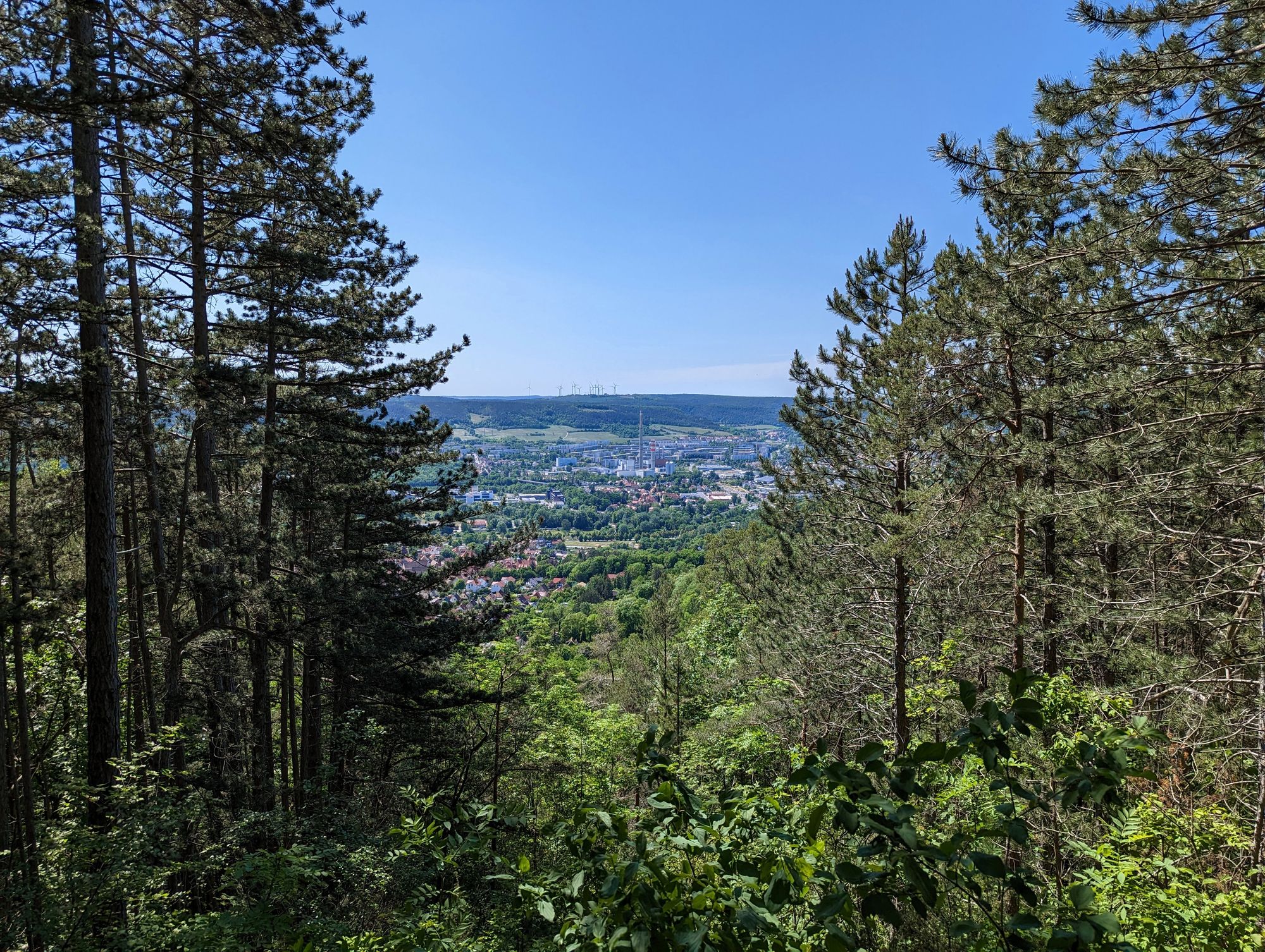
Jena, a charming city located in the eastern part of Germany, beckons visitors with its rich history, academic prowess, and picturesque landscapes. With a population of approximately 110,000 inhabitants as of 2022¹, Jena offers a vibrant urban experience amidst its natural surroundings. Situated in the state of Thuringia, Jena lies about 200 kilometers (124 miles) southwest of Berlin², making it easily accessible for travelers.
Jena's climate is classified as temperate, with warm summers and chilly winters. The city experiences an average annual temperature of around 9.3°C (49°F)³, which lends itself to pleasant outdoor activities throughout the year. Nestled in the Saale river valley and surrounded by rolling hills, Jena boasts a picturesque geographic location that serves as an ideal base for hiking, biking, and exploring the nearby Thuringian Forest.
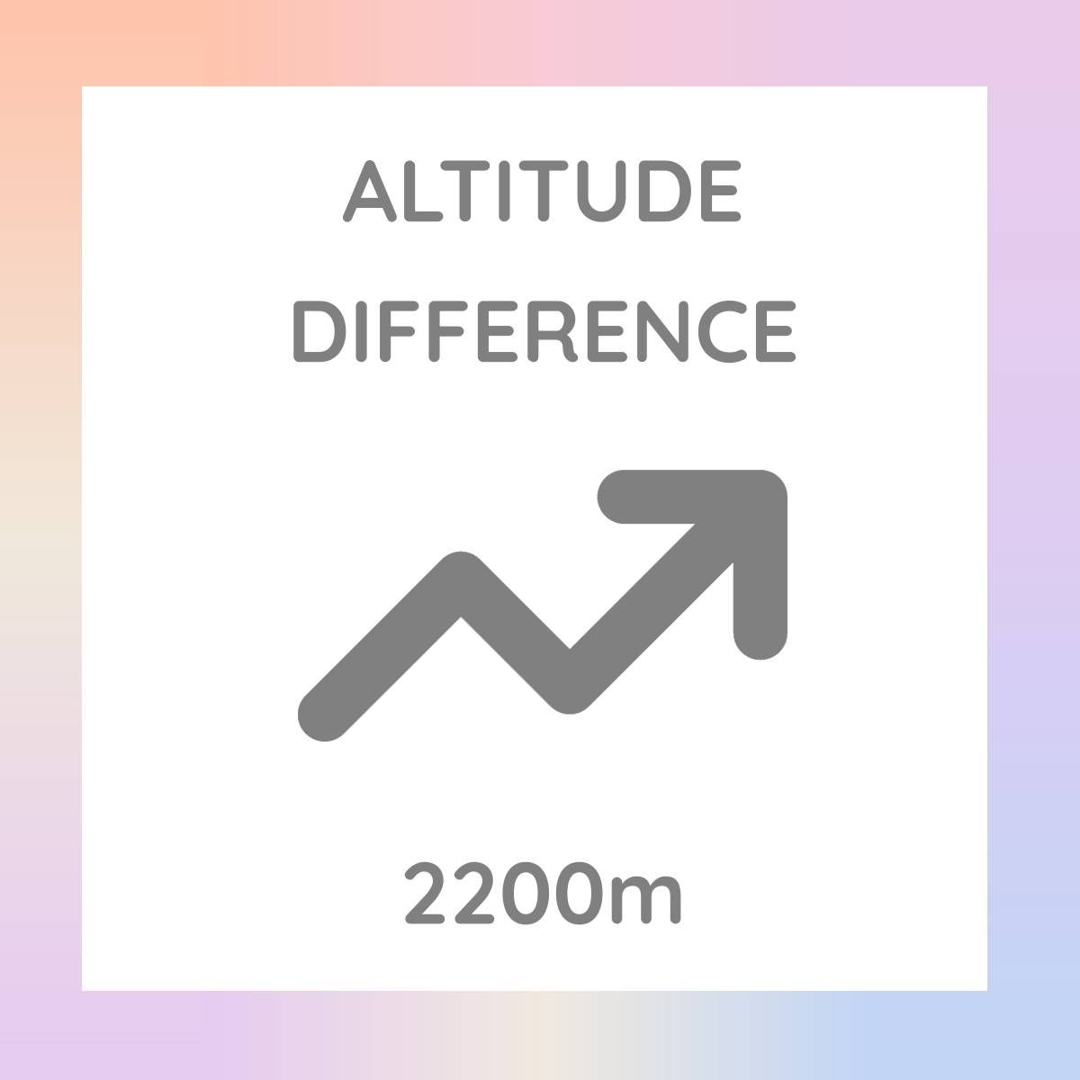
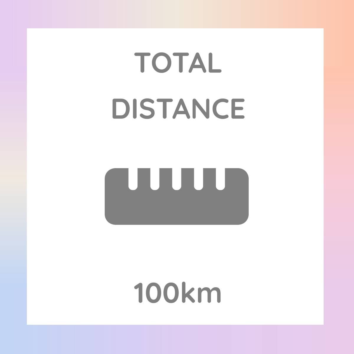
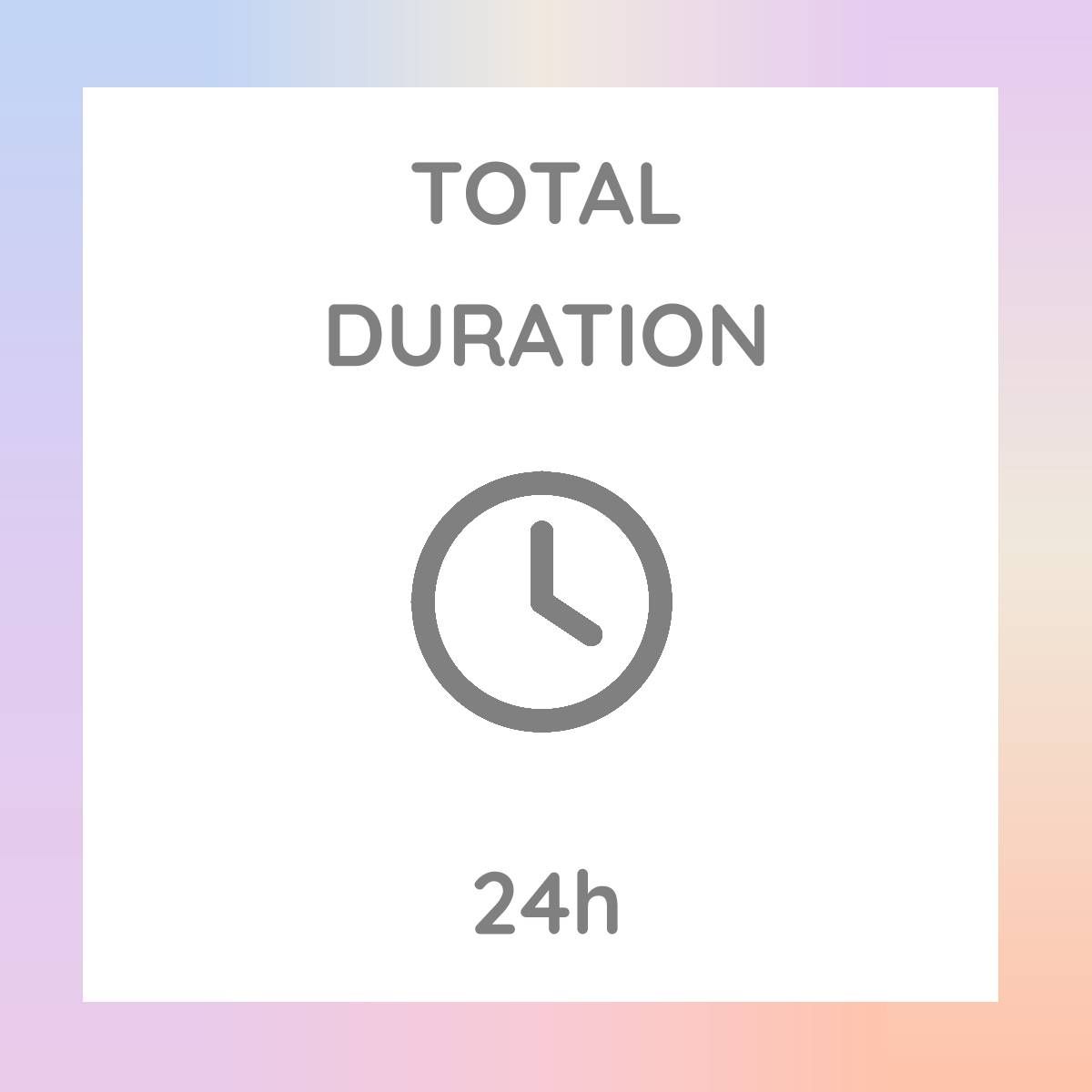
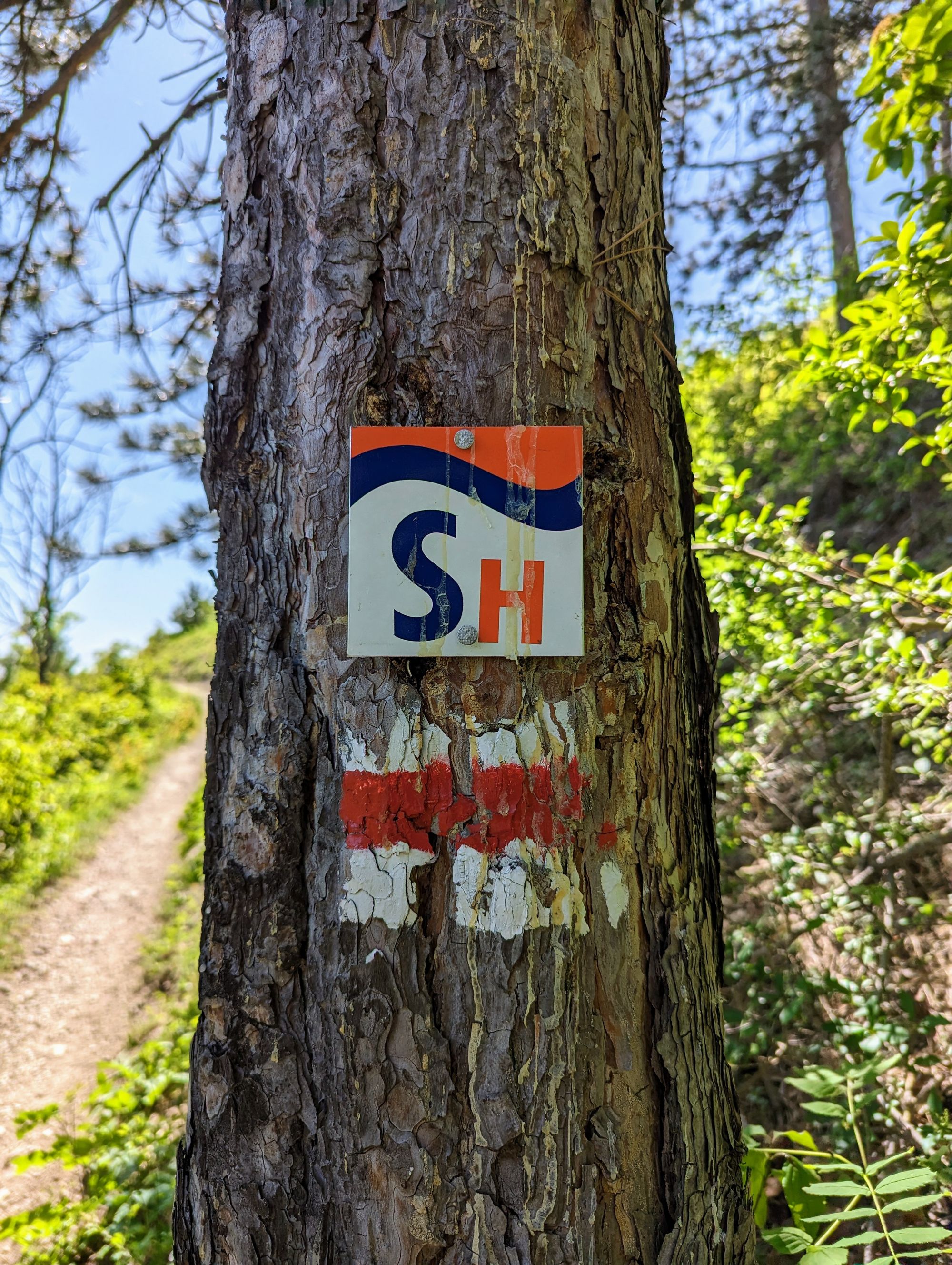
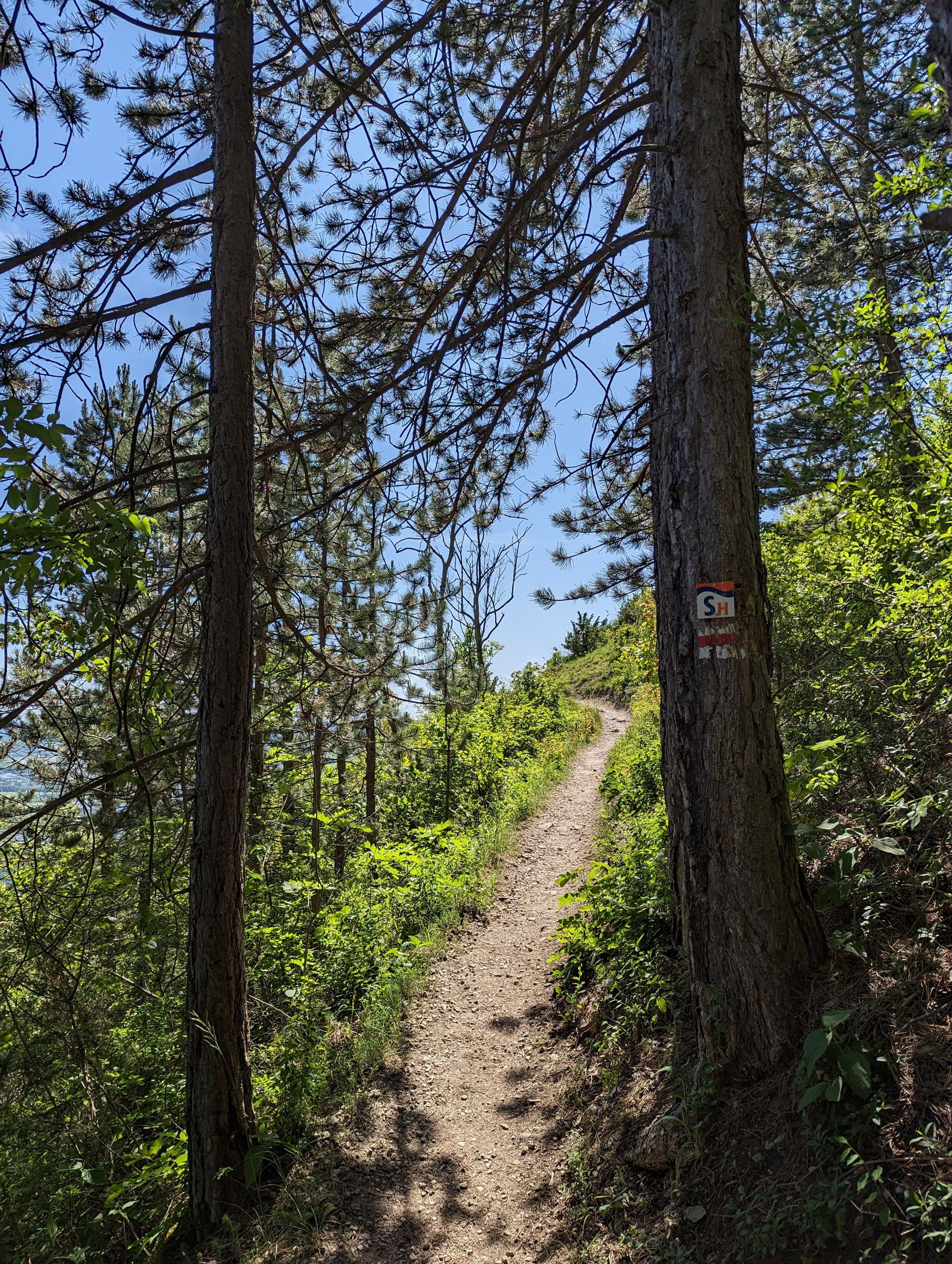
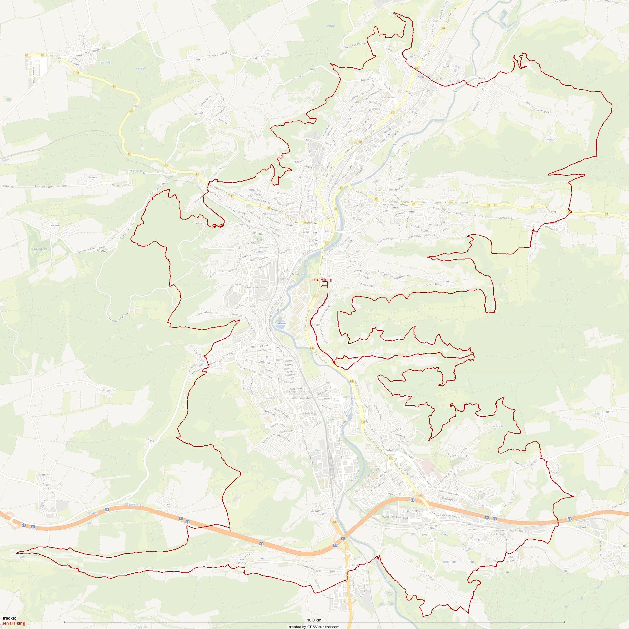
The "Horizontale - Rund um Jena" is an endurance hike which is organized by SG Carl Zeiss Jena-Süd e.V. and WSG Lobeda e.V.⁴ Once a year⁵ one thousand participants embark on this 100 kilometers (62.1 miles) twenty-four hours long-distance walk around the city on a trail called the SaaleHorizontale⁶. It's a challenging route which not all starters complete, in fact only roughly half the field finishs the hike. In even-numbered years, the route leads clockwise around Jena, and in odd-numbered years, counterclockwise.
Do My Knees Hurt? Do My Feet Hurt?
The Horizontale offers breathtaking views and wonderful scenery, but it is undeniably challenging, both physically and emotionally.
It compels you to test your limits, and inevitably, you'll find yourself asking questions along the way. Why am I doing this? Do I have to? Should I stop? I could be sitting at home on the couch. Do my knees hurt? Do my feet hurt? Perhaps I should be sitting at home on the couch!
However, I embraced the challenge. Looking back, it was undoubtedly a great adventure, albeit one which I don't want to repeat any time soon.
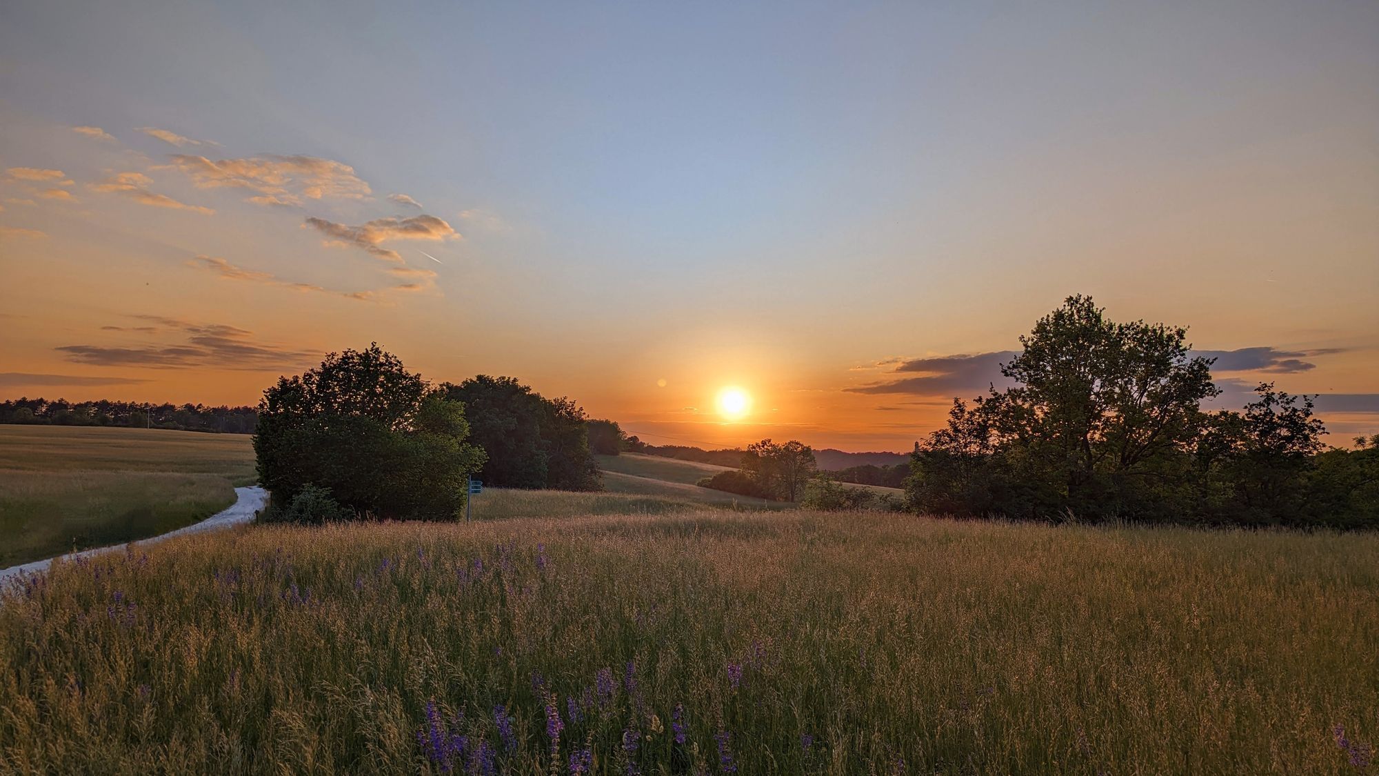
Start to Sunset
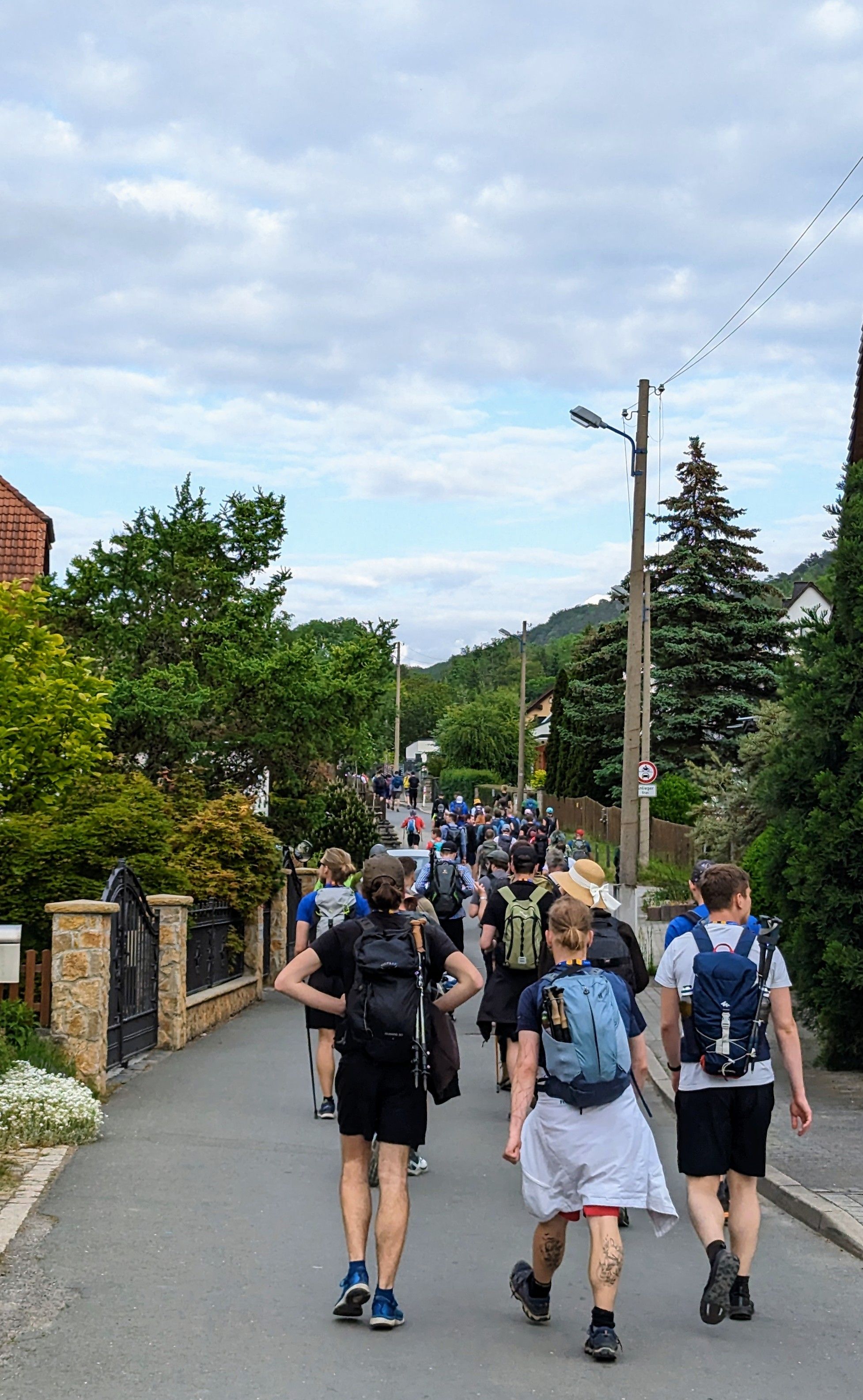
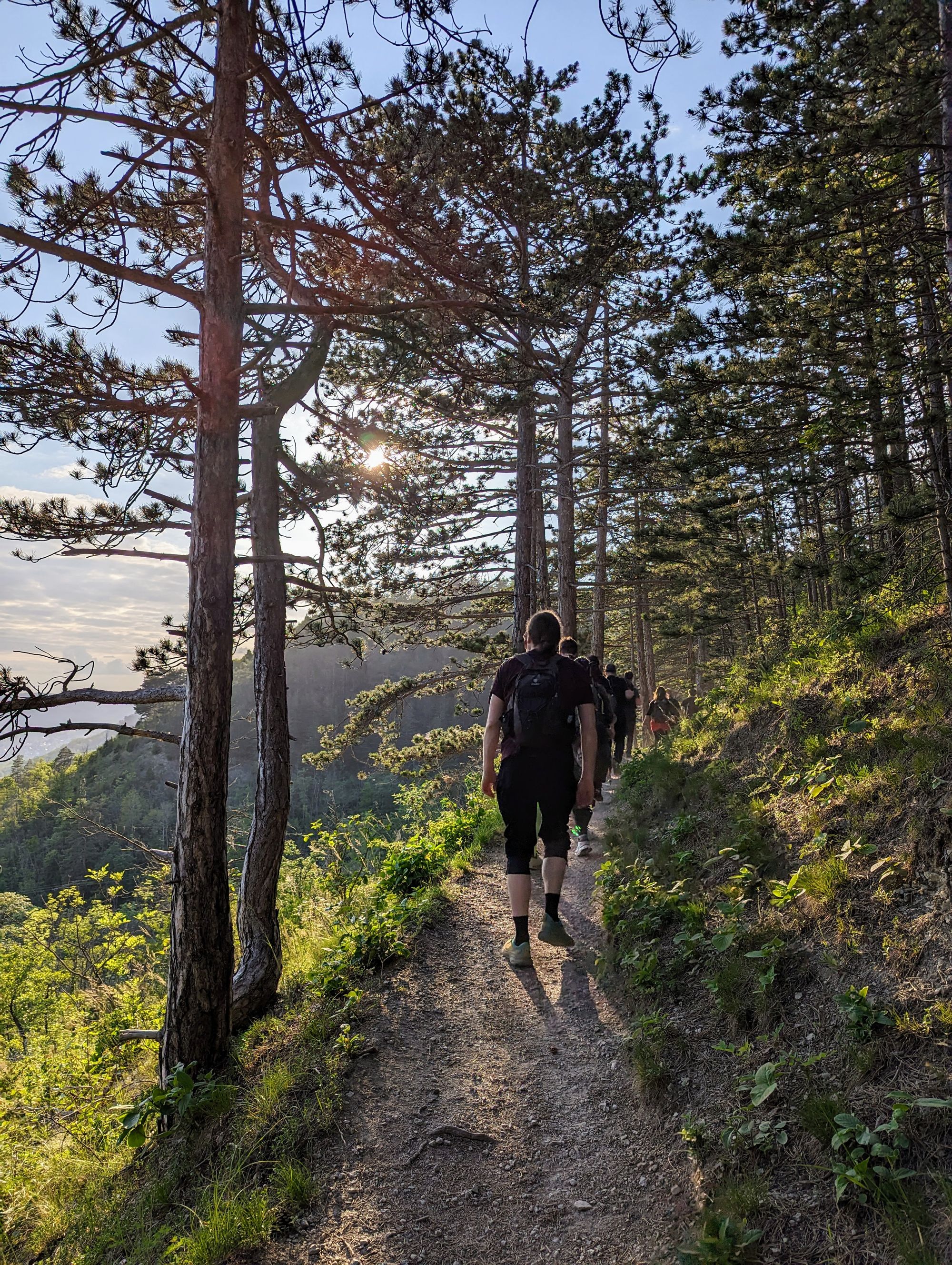
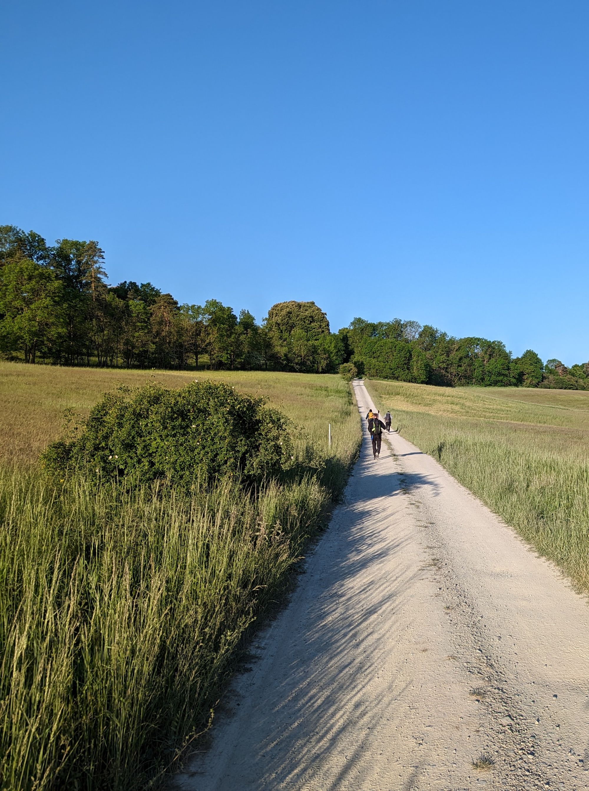
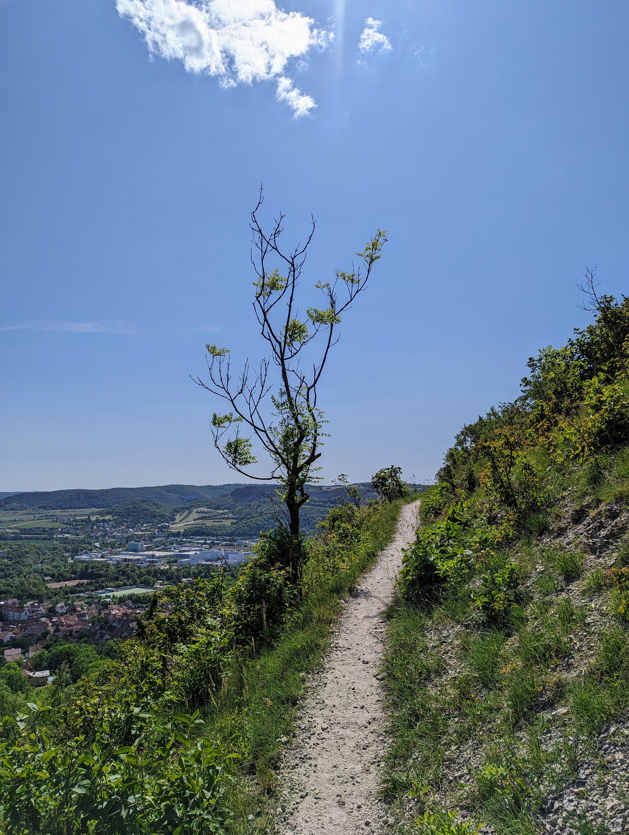
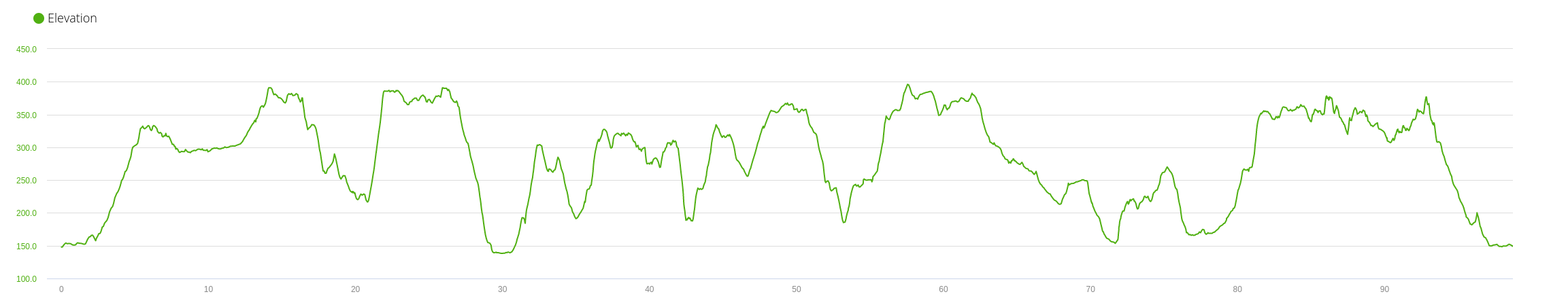
As expected, the most pleasant part of the hike awaited right at the beginning. Amid mild temperatures of 18°C, a good friend of mine and I set off at around 18:10. We allowed the first wave of participants to head out before us, but the entire field remained tightly packed for the initial couple of hours. The route led us to the Fürstenbrunnen and then ascended the Hausberg, we then passed the Fuchsturm. After approximately four hours, we arrived at Wogau/Jenaprießnitz, where the first control point and refreshments awaited.
The Night and Morning
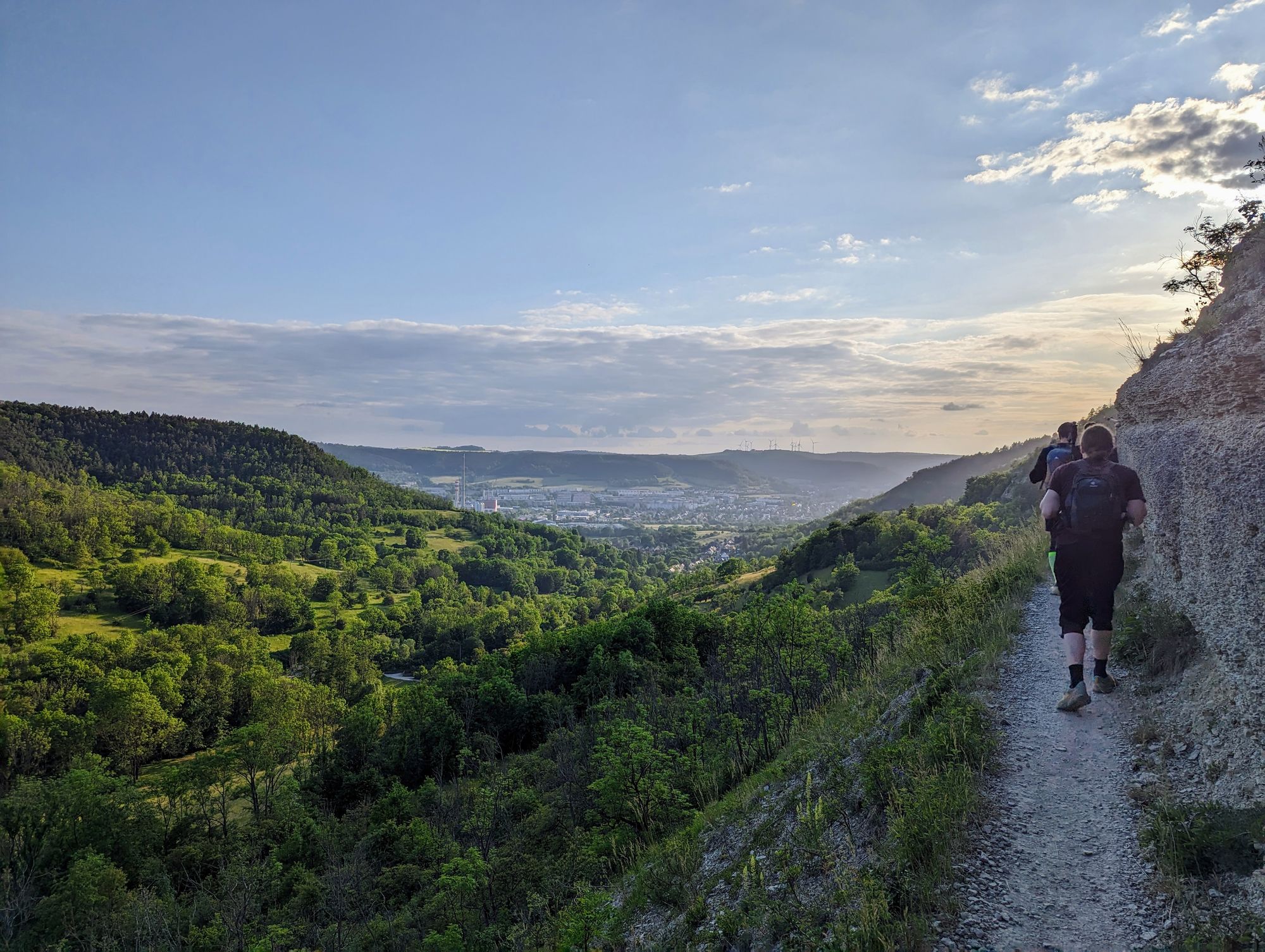
Right after we departed from the first control point, the sun quickly set, and the temperature plummeted, night awaited. We swiftly ascended the Jenzig, and from there, the route stretched out on an elevated plain for about an hour until we reached Kunitz/Zwätzen, where we descended back into the valley. It was around midnight, and at that point we had completed approximately 30 kilometers. The next challenge presented itself with the climb up Windknollen hill. It wasn't until 9 hours into the hike, around 3:00 in the middle of the night, that we finally arrived at the second control point. After a short break and shivering from the cold the best thing to do was to keep moving. Through dark forests, we continued our journey, now fully heading South-West away from Jena. As the clock approached 5:30, the sun began to rise and I celebrated every ray of sun to warm me up. We passed by small meanders and fields, garnering curious gazes from farm animals along the way. Our pace remained steady, pausing only for essential breaks or a sip of water and a quick muesli bar. Finally, at 8:00, after covering a staggering 65 kilometers, the third control point awaited us, offering a much-appreciated respite.
The Gruesome End Stretch
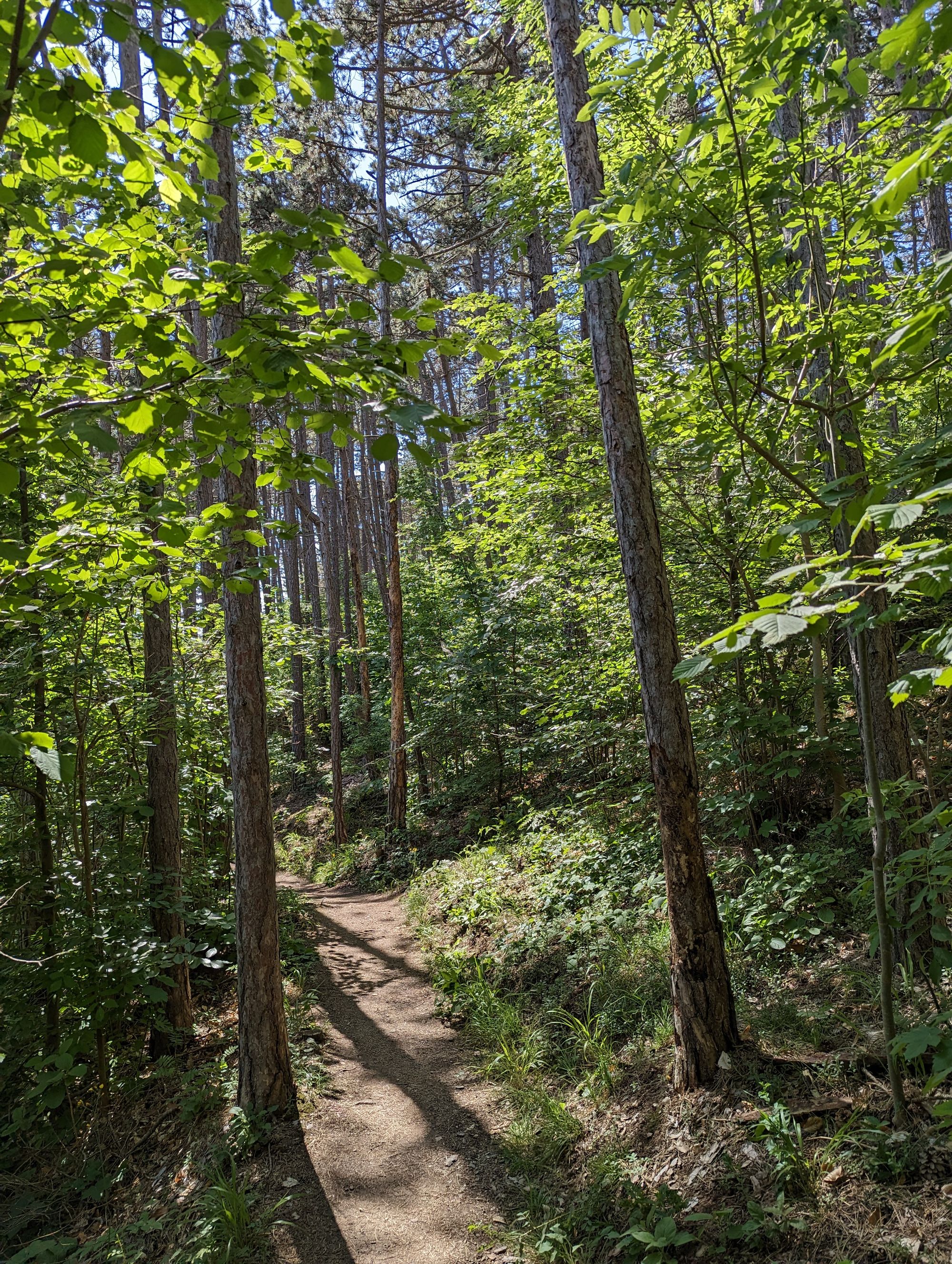
The morning brought sunshine and rapidly rising temperatures; however, after covering 70 kilometers, I felt every muscle and joint in my legs with each step. Our pace dropped significantly, and frequent stops became a necessity. The climbs up to Sulza from the Saale/Leutra confluence in Maua and later to the Wöllmisse from Ilmnitz proved to be arduous and demanding. We took in a glimpse of the Lobdeburg as the trail took us past Georgstein towards the final control point near the Sommerlinde. At this point my energy was at a low point. The sun was baking the sandstone rock. The narrow path, with a sharp descent on one side and a steep ascent on the other, seemed to get narrower with every kilometer.
Around kilometer 85 it happened, I slipped but was able to regain my balance just in time. My hiking companion was a bit ahead but I was able to signal to him to stop. We made an emergency break and I finished the last provisions, just enough to get me to the final control point. I toyed with the idea of aborting, fearing another slip and the potential peril of a fall down several hundred meters. But a fresh injection of sugar from more refreshments at the final control point and the decision to split and proceed at our individual paces led me to reconsider. Approximately an hour later we arrived back at the Fürstenbrunnen, leaving only 5 kilometers before reaching the finish line.
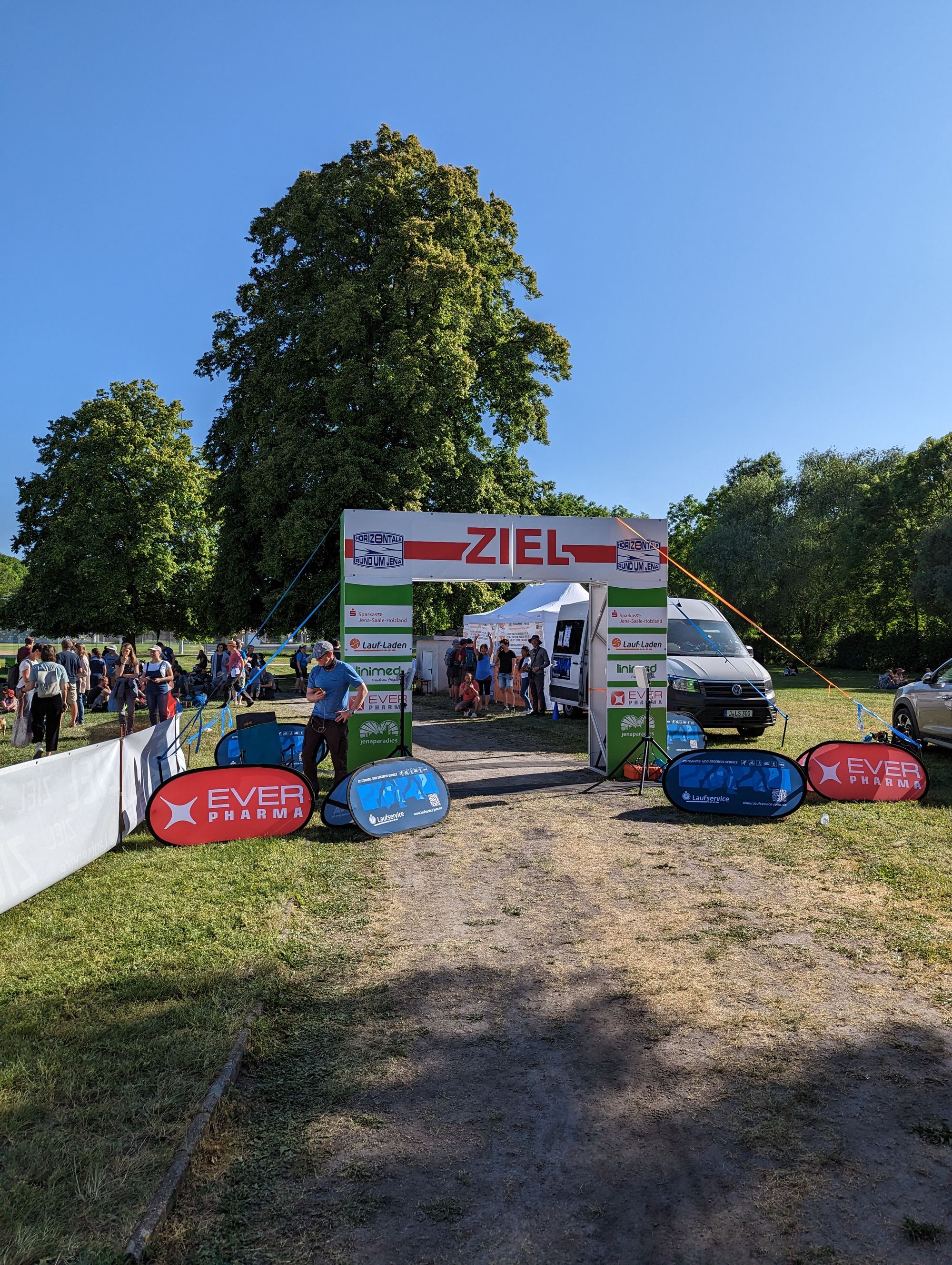
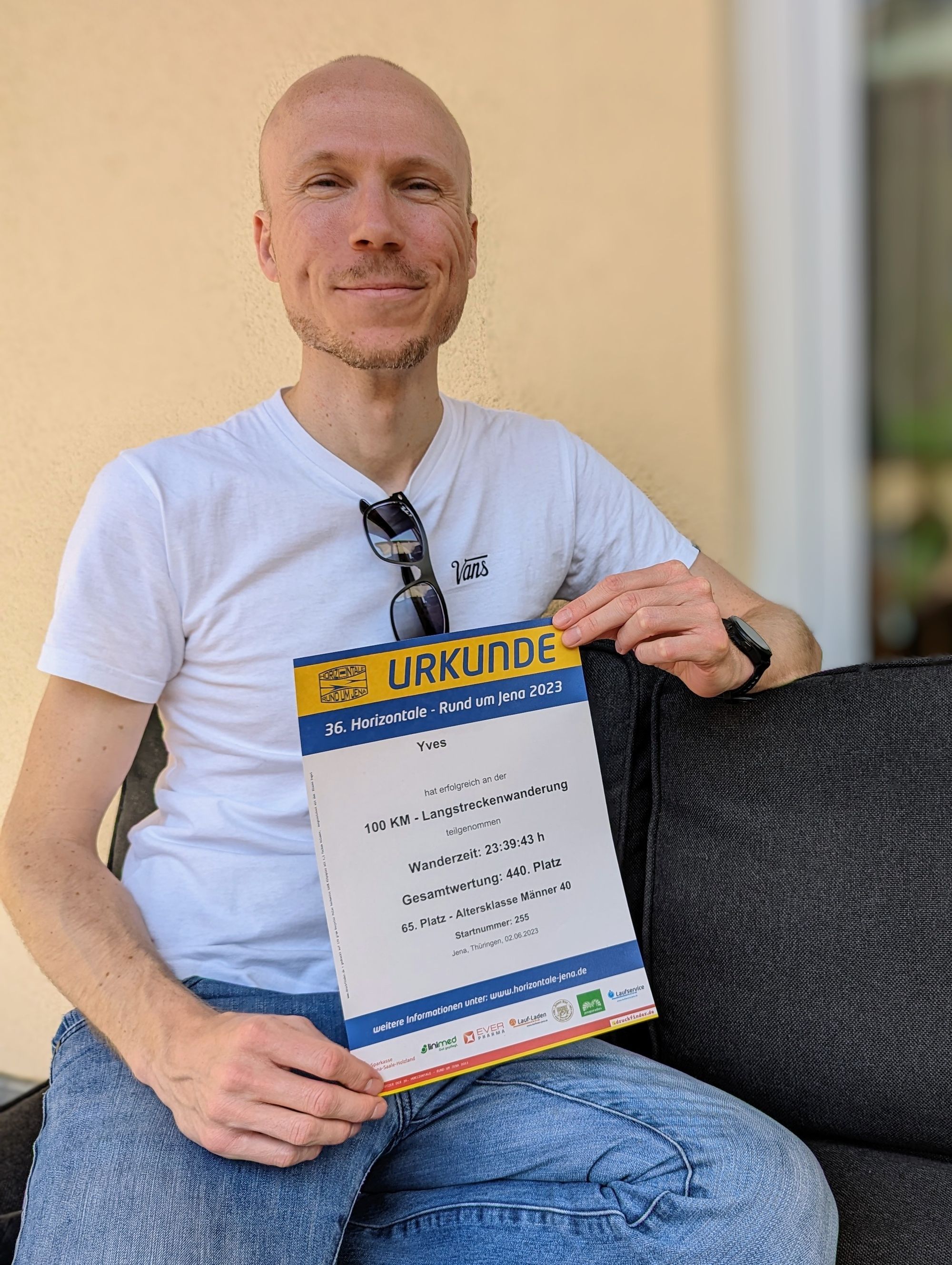
After 23 1/2 hours, we arrived where we had started. Within seconds, the pain in our legs and the fatigue from being awake for more than twenty-four hours were forgotten. Happy and elated, we collected our certificates, mugs, and pins—a set of souvenirs every finisher receives— and vowed to never return, we would stay one time finishers.
Sources
¹ Statistisches Landesamt Thüringen (Thuringian State Statistical Office): https://www.statistik.thueringen.de/datenbank/TabAnzeige.asp?tabelle=kv000101
² Google Maps: https://www.google.com/maps
³ Climate-Date.org: https://en.climate-data.org/europe/germany/thuringia/jena-2131/
⁴ Horizontale - Rund um Jena: https://www.horizontale-jena.de/
⁵ Jena Tourist Information: https://www.visit-jena.de/story/saalehorizontale-olaf-schubert/
⁶ Jena Tourist Information: https://www.visit-jena.de/story/100-kilometer-zeit-fuer-sich-selbst-hartmut-rosa/